Hike 17 - America Hill

I can’t believe it’s been 6 months since I officially logged in a hike. I’ve been on some walks, but didn’t take advantage of any winter hiking. At any rate, I am ready to get back to it this year. My first official hike of the year was in the Virgin Islands. We’d gone to St. John, USVI 10 years ago (it’s where we got married) and hiked Ram Head Trail at that time. It’s a great trail with fantastic views, but absolutely no shade. We headed out early, but I still ended up with heat stroke. It was horrible and when Jesse suggested we do it again I had to shut him down. Once was enough. Plus, this island has a ton of trails - most of the island is a national park, so I wanted to explore something new.

2019-05-07_0001.jpg

I wanted a trail with shade and a local recommended America Hill Ruins. To get there, you start at Cinnamon Bay Trail and walk up a steep hill before turning left on the America Hill trail head. We went early to try and avoid the heat, but it’s never really cool in the Virgin Islands so it was a humid and sweaty hike to the top. We counted down our five switchbacks and were rewarded with an amazing view at the top. Once back down we walked over and did the Cinnamon Bay Loop Trail as well. It’s a short, mostly paved trail around some ruins with guided signs.

2019-05-07_0002.jpg

Hike #: 17

Trail: America Hill Ruins

Location: St John, United States Virgin Islands

Trail surface: Dirt, rocks, leaves (paved and boardwalk on the Cinnamon Bay Loop trail)

Date: 4/20/19

2019-05-07_0003.jpg

This certainly wasn’t a long hike, but it wasn’t an easy hike either. It’s totally doable, just be prepared for the incline and the heat. Gratefully, there was a lot of shade and a beach nearby that we cooled down in afterwards. We all agreed that we took a point off for the heat. Jesse also noted that there wasn’t much to look at on the way up, but the view at the top was worth it. I’m not sure what he wanted to see (animals, flowers?), but I enjoyed the forest feel of the hike. Riley also took a point off because she was tired, but I wouldn’t hold that against this trail. :)


Jo: ★★★★

Jesse: ★★★

Riley: ★★★


Hike 16 - Eagle Mountain

Jesse, Riley and l had a number of days off in October and we debated on how to use those. At one point, we were going to do a family activity, but in the end Jesse and I decided to do a bigger hike so we left Riley with her grandparents and headed up to the North Shore. I really wanted to hike Bean and Bear Lake, but the weather forecast didn’t look great for a backpacking camping experience. So we changed our plans to hike Eagle Mountain on our first day since it would be nice and then decided to play it by ear for the next day when it was supposed to be really cold.

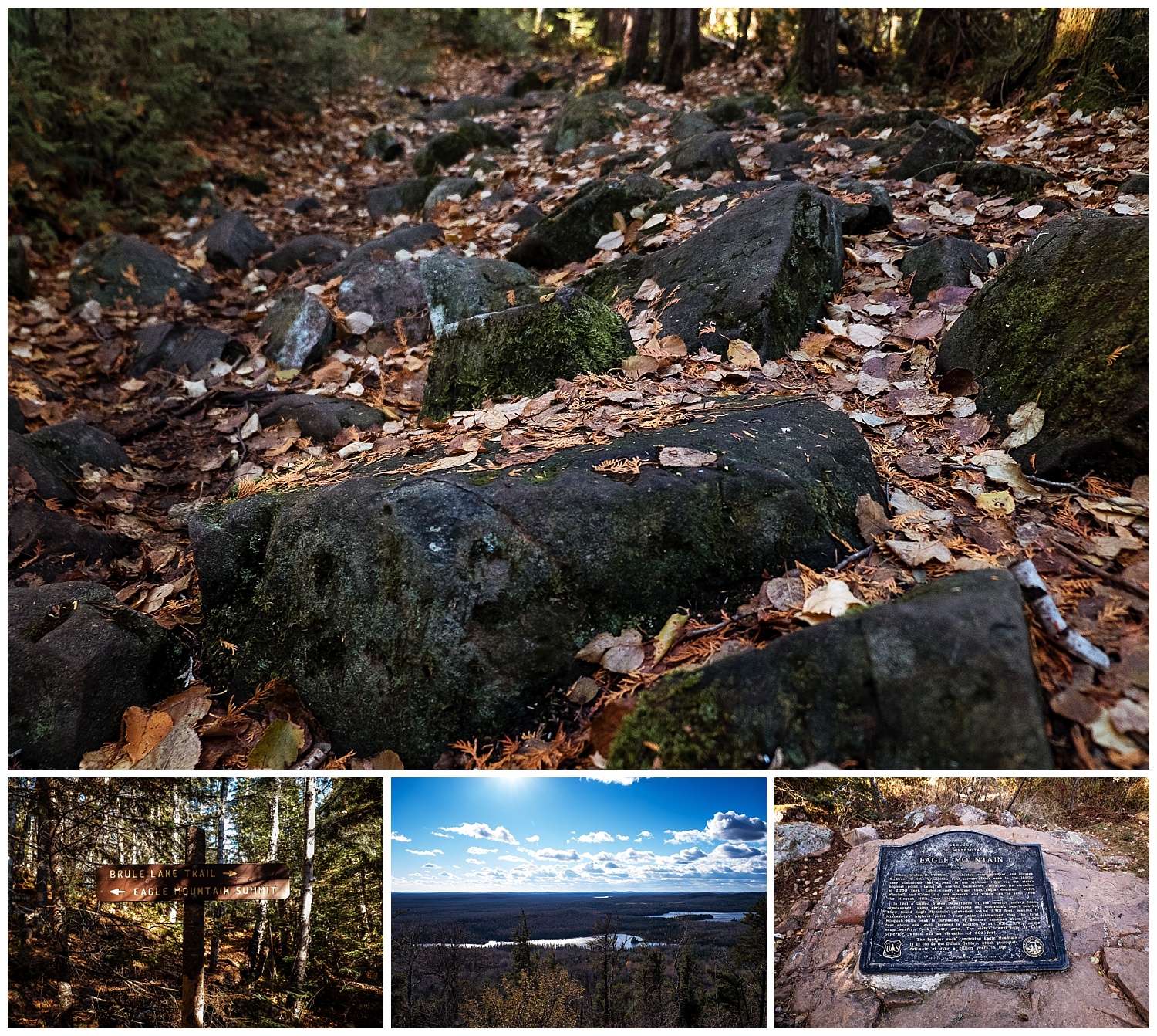
2018-11-02_0001.jpg

Hike #: 16

Trail: Eagle Mountain

Location: West Cook, MN

Trail surface: Dirt, rocks, tree roots, wood over marshy areas, rocks, rocks, rocks…

Date: 10/19/18

Note: The trail is partly within the Boundary Waters and you can grab a permit at the trail head.

2018-11-02_0002.jpg

Eagle Mountain is the highest point in MN at 2301 feet. While that’s not incredibly high compared to high points in other states, I was still a bit concerned as I don’t do great with climbing up. However, most of the trail is fairly flat - or rolling and it’s only the last bit of trail that ascends up the mountain.

It still kicked my butt.

The trail is mostly rock and tree roots which means that you are hiking mostly head down to make sure you don’t land on your ankle (I still did twice, but was fine).

2018-11-02_0003.jpg
trail-us-minnesota-eagle-mountain-trail-at-map-21721615-1541209674-1200x630-3-6-p-1.jpg

This was Jesse’s third time hiking this trail and he noted that doing it in the winter was the easiest and I totally see why. Walking over rocks and tree roots constantly did a number on my knees (between that and the bitter cold the next day we didn’t get in another hike). The trail also could have used some maintenance… the water level was high and with the help of some beavers, the water overflowed over wooden planks which meant we had to take our shoes off to walk through part of the creek. I didn’t really mind though as it was all part of the adventure. The North Shore trails are what really feel like hiking trails to us, and the only reason we didn’t give this one a 5 star was because the trail surface is killer. I was surprised to see young to old complete this trail.

Jo: ★★★★

Jesse: ★★★★

2018-11-02_0004.jpg


Hike - 15 - Big Willow Park

I’ve driven past these ballparks in Minnetonka so many times and had no idea that there were a bunch of trails behind them until my neighbor mentioned that it was a favorite place of hers. I finally gathered up my family one day after an especially lazy morning and we headed over to check it out.

2018-10-22_0016.jpg

Hike #: 15

Trail: Big Willow Park

Location: Minnetonka, MN

Trail surface: Crushed rock, dirt

Date: 9/30/18

Big Willow really was a huge surprise. I expected paved trails around the sports field, and that’s about it, but in reality it was like walking in the forest along a creek bed. There were a number of short off shoot trails that brought you back to the main trail as well which was nice.

2018-10-22_0018.jpg
at-map-21489416-1538342041-1200x630-3-6-p-1.jpg

Perhaps because our expectations were low we ended up all really liking this trail, but I think it’s a great near the city trail. It was clean, and near our house which is a bonus, but we’ve found that we tend to like trails that feel more like you are in the middle of the woods and this one fit that very much.

Jo: ★★★★

Jesse: ★★★★

Riley: ★★★★

2018-10-22_0017.jpg